For indexing purposes, the streets along this part of Westgate have tags which allow you to filter your search using the tag cloud at the bottom of every screen. That part of the street which lies to the West of the conservation area is indexed West End and all side Streets called by their names: Mount Lane, Henty Gardens & The Maltings, St Bartholomew’s Close and Tannery Close. Enter one of these names into the search box and all articles with that name in the text or title will come up. The historical Conservation Area is labelled just that.
Westgate is further divided into north and south sides to avoid any confusion with the numbering.
Residents and house names at the Western End of Westgate 1932-1950
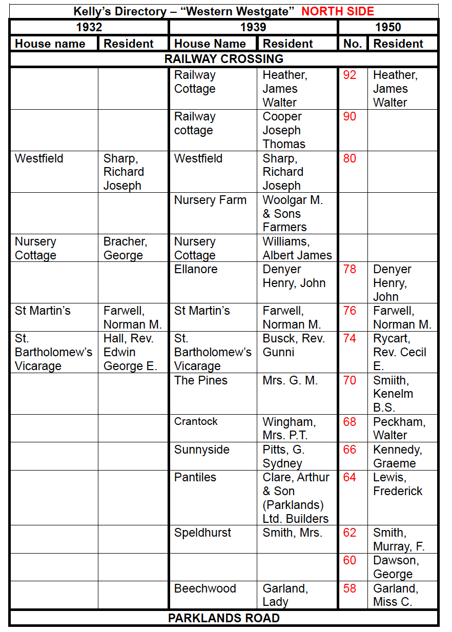
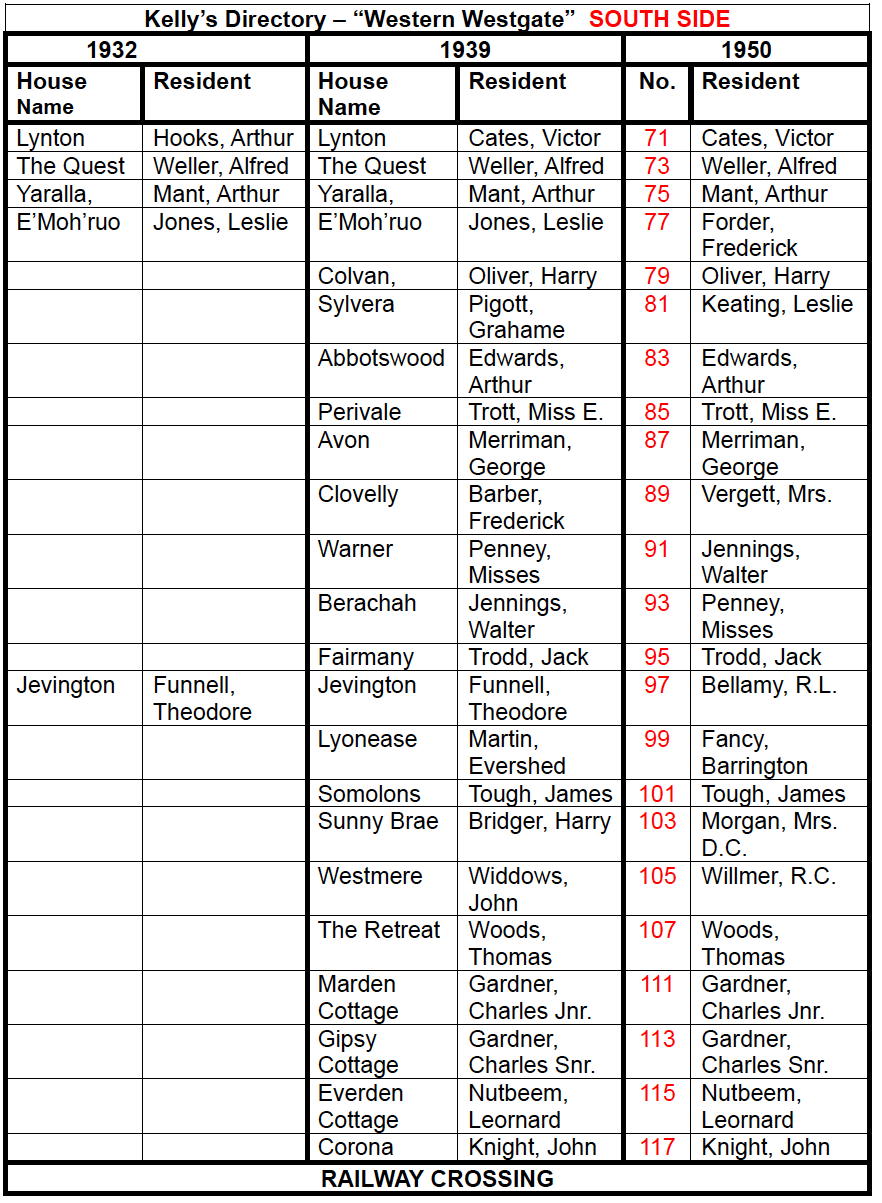
By perusing the Kelly’s Directories for Chichester published in 1932, 1939 and 1950, Dr Brownfield has been able to construct a history of the residents living from 58 to 117 Westgate. One can see from these in what order these properties were added.
Health Warning – We recognise that these tables will be hard to read for some and, while zoomable even on a smart phone or tablet, we would recommend you use a computer or television screen to enlarge.
Northside Properties
Residents in 1932, 39 and 50 at the western end of Westgate, Northside – and the names of the properties before numbering came in – were:
Southside Properties
Residents in 1932, 39 and 50 at the western end of Westgate, Southside – and the names of the properties before numbering came in – were:
We hope this makes a useful start to constructing the history of C20th Westgate. If you have any data about these properties and their history do please contact us.
The Side Streets
The originating histories of the side streets (why and how they got built) are in construction and will be published and material is amassed. Read here for starter articles on Mount Lane and Henty Gardens. St Barthlomew’s Close and Tannery Close to come.
Thank you.
Table prepared by Richard Brownfield 2023
Other additions by Colin Hicks 2025