Historic Maps of Westgate

Roman Roads (© David Stokes)
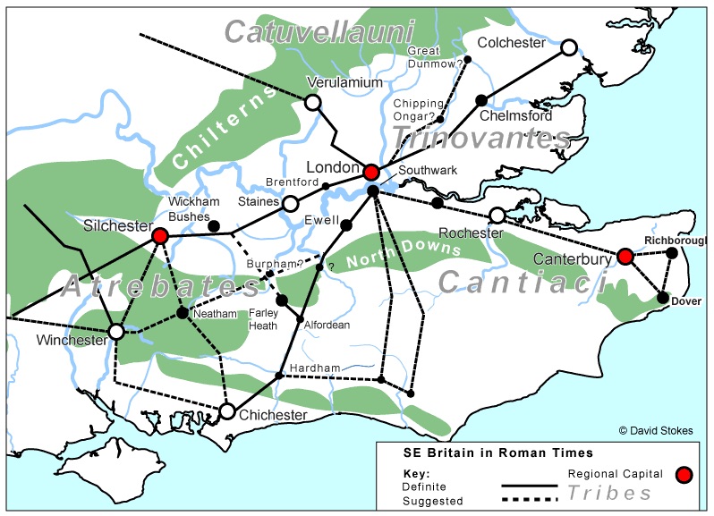
Westgate was not a metalled road in Roman times, although it was an important route to the palace at Fishbourne, onto Bitterne and then Winchester. Note the short road from Chichester to Dell Quay in the south, which came into use when Fishbourne Harbour silted up and the main port for goods and people was moved there.

Continue reading Historic Maps of Westgate
Mount Lane

The Westgate (St Bartholomew’s) suburb contains not just the main street but a collection of side streets that lead off the main road. This is part one of a series designed to present each of these in their own right. You can read about Henty Gardens and The Maltings here. It does re-use some material from earlier articles that risks being missed since it is scattered other postings.

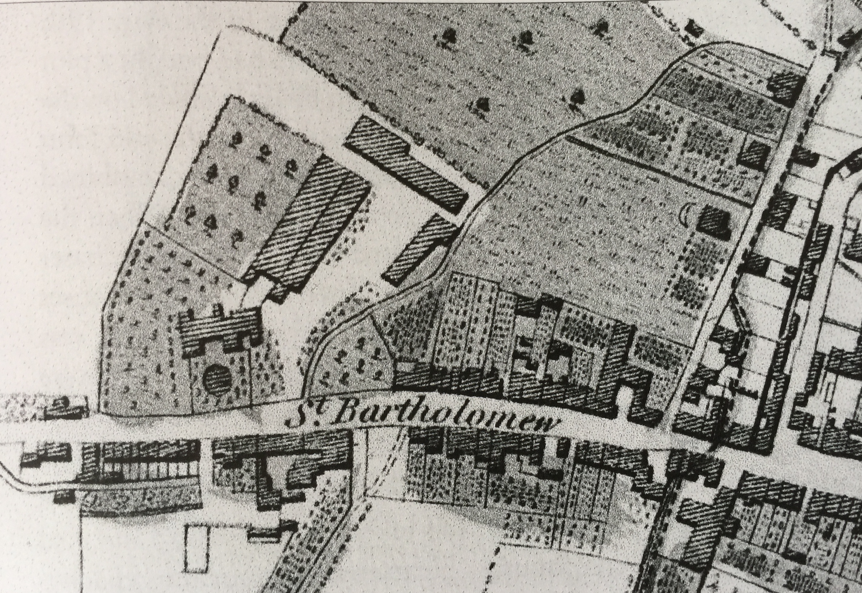
The early history of Mount Lane is hard to identify. It is probable that there has always been a series of tracks leading from the Portsmouth Road into the Westgate Fields and of which the modern Mount Lane is a survivor. Perhaps because a church stood on the corner and the distant memory of a wayside Roman temple persisted.

Continue reading Mount Lane

The road we call Westgate (updated)

This is a comprehensive rewrite and expansion of my original 2017 post, recently undertaken by Dr Richard Brownfield. It pulls together a lot of different sources and is as full a historic description of the street as can be achieved. A major piece of research and a fascinating read.

Westgate is the road that left Chichester by the West Gate leading out of the Roman walls. The actual gate was demolished in 1773 but the south pillar is still standing, complete with a hinge (pintle), beside the Indian Restaurant. Westgate is also used to describe the ancient western suburb of St Bartholomew’s in Chichester, which grew up along the road that emerged beyond the West Gate.

Continue reading The road we call Westgate (updated)

The Chichester Walls and Gates

The Roman army, after landing at Fishbourne in AD 43, set up a camp on the site which is now modern Chichester and fortified it with a wooden wall. The town was laid out on a grid with the main streets North and South Street, East and West Street, which crossed in the centre of the town. Where they met the wall there was a gate.

Continue reading The Chichester Walls and Gates

Westgate Archaeology

 This section is edited from articles published by Colin Hicks on the original Westgate Residents Association Website, which were adapted with their permission from an archaeological desk-based assessment prepared by SLR Consulting Ltd on behalf of Chichester College in 2013. Richard Brownfield has very usefully brought these all together, updated and developed them to create a fascinating tour of the history of the western/St Bartholomew’s suburb.

Continue reading Westgate Archaeology

Hidden Westgate Histories 10: Demolished properties Southside

The following properties to the south side of Westgate were demolished in 1963 to make way for the Avenue de Chartres and the Chichester inner ring road.

For information concerning the lost buildings to the north side of Westgate, please click here.

Continue reading Hidden Westgate Histories 10: Demolished properties Southside

A Chichester History 

Chichester is the only city in Sussex and owes its existence entirely to the Romans. There is no evidence of any form of a major settlement in the area before their arrival. The local iron age people lived in farmsteads rather than towns, although they were organised and there is evidence of considerable trade with the Mediterranean before the Roman invasion. In 40 CE Verica was their leader in the early part of the first century but lost control and fled to Rome to ask for support.

Continue reading A Chichester History 

Westgate Timeline

43CE The Roman Second Legion land at Fishbourne and set up camp on the site which will become the palace of Togidubnus, vassal king of the Regni. Later they march inland under the command of Vespasian, probably along the track which was to become Westgate. They set up a winter camp on the flat plain just before the first undulations of the South Downs. They fortify the camp with a ditch, and an earth and wooden wall. 

Continue reading Westgate Timeline

Hidden Westgate Histories 1: St Sepulchre Round Church

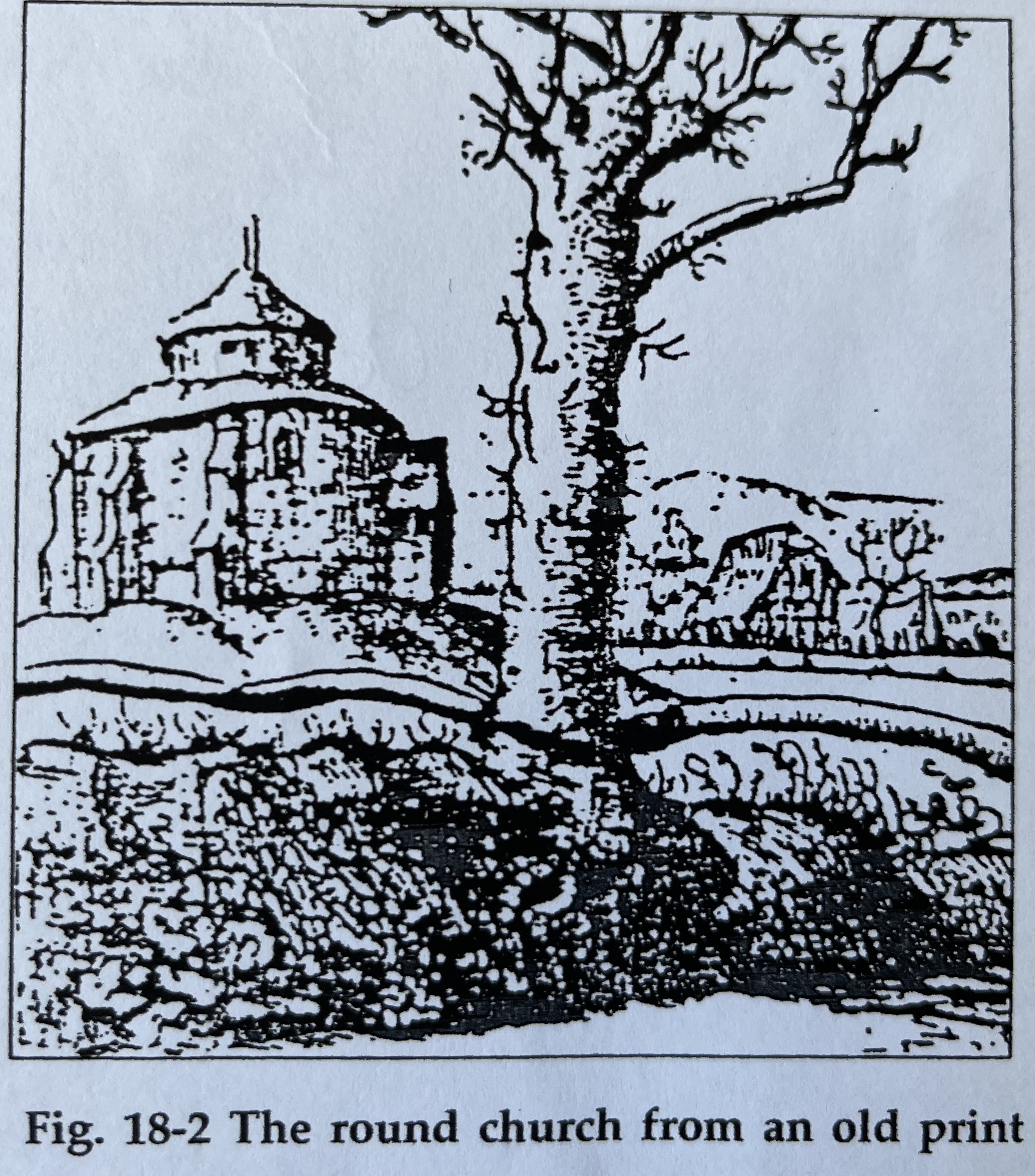
The former St Batholomew’s Church in Mount Lane off Westgate is not the first church to have appeared on this site. The suburbs extra muros of St Pancras to the east and of St Sepulchre to the west date back to Roman times, both housing 3rd century cemeteries within their parishes, with the main one to the east (the Litton), in part where the modern Litten Gardens is on New Park Road. The remainder is under the New Park development and car park on the opposite (west) side of the road.

Continue reading Hidden Westgate Histories 1: St Sepulchre Round Church

Hidden Westgate Histories 4: The Westgate Lavant

Most residents are familiar with our winterbourne, the River Lavant. Winterbourne because it is a seasonal stream that comes down from the Downs, filtered out of the chalk after the Winter rains.

Continue reading Hidden Westgate Histories 4: The Westgate Lavant
Translate »
error: Content is protected !!