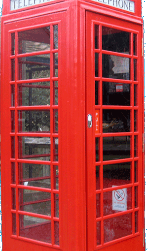
Did you know that the red telephone box on the corner of Parklands Road and Westgate is protected, and listed grade II? It was listed in July 1995 by Historic England, sixty years after it had been erected.
Author: Colin Hicks
Site Admin - Westgate street history, Chichester

Hidden Westgate Histories 7: The Westgate War Memorial (updated)
I doubt that many people living on/by Westgate, or walking up and down the street, know that we have our very own War Memorial commemorating the Fallen of the Parish of St Bartholomew.
Continue reading Hidden Westgate Histories 7: The Westgate War Memorial (updated)
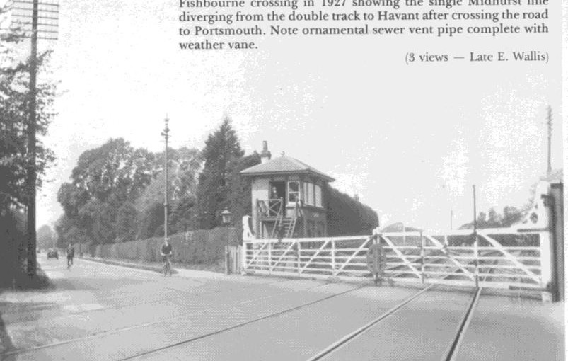
The Chichester and Midhurst Railway: Level Crossing
Article adapted from one originally researched and compiled by Paula Chatfield of Parklands RA for her excellent Easter Trail series and re-published here by permission.
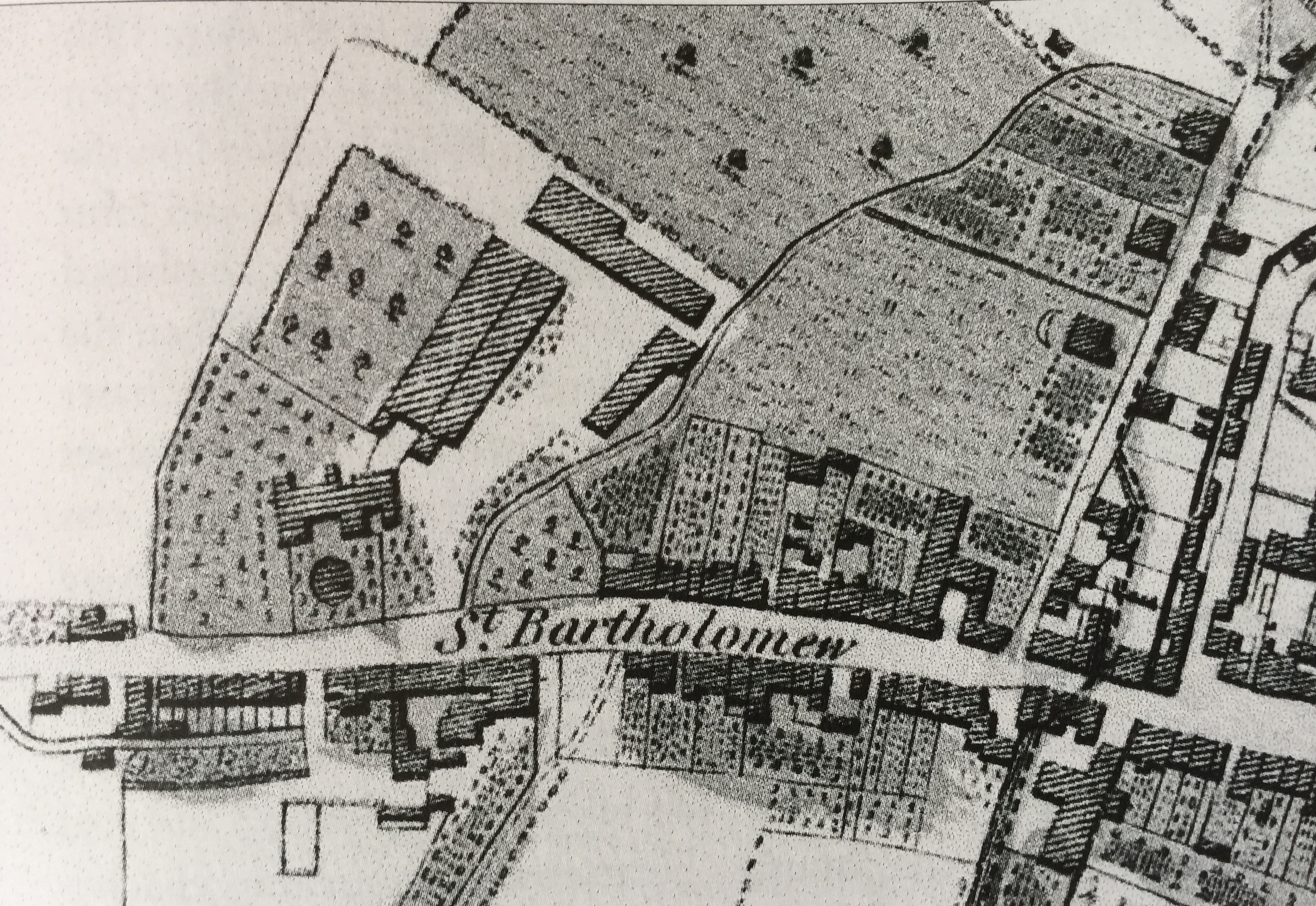
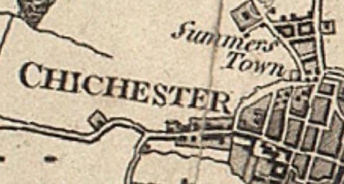
Before the railway arrived (see 1813 map below), the Westgate/Fishbourne Road was the main road (for foot and horse traffic) between Chichester and Portsmouth.
Continue reading The Chichester and Midhurst Railway: Level Crossing
Suburb of St Bartholomew’s: C19th population
This text is the last in our series about the Suburb of St Bartholomew, through which Westgate runs. It consists of edited data selected from the 19th century censuses for the historic suburb of St Bartholomew (1801 to 1891)
Continue reading Suburb of St Bartholomew’s: C19th population
Opening of The Brewery Field – June 2016 (updated)
Residents will probably know by now that the Field behind the County Record Office in Orchard Street has been taken over by Chichester City Council on a 25-year lease from the County Council for the use and enjoyment of all. It is very unusual these days to be able to organise the birth and activities of a new park in a City, particularly one in a conservation area and so close to the City Centre.
Continue reading Opening of The Brewery Field – June 2016 (updated)
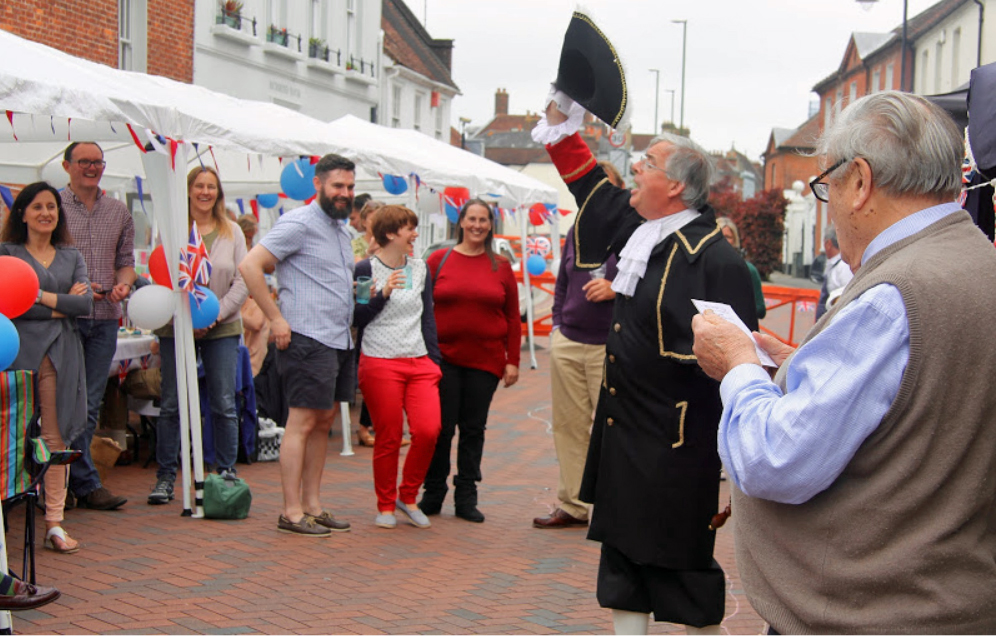
Hubert’s Street Party Poem – June 2016
Every year famous resident Hubert Doggart, the cricketer, wrote a special poem for the annual Street Party. Here is his verse for the event in June 2016
‘ELIZABETH the FIRST’
(and her astonishing – but not surprising – to date, 64-year-long reign.)
Chichester & St Bart’s: the Architecture of the City
This text was originally the fourth in a monthly series of five about the suburb of St Bartholomew’s Without in the wider context of the development of the City of Chichester. It is drawn from an edited extract of a 1935 publication (details below). As such it has kept a centuries-old way of talking about Chichester where the city walls, gates, ditch and parishes defined our boundaries, untrammelled by the modern changes that not much more than five years later would come finally to disrupt the millennial harmonies of our cityscape.
Continue reading Chichester & St Bart’s: the Architecture of the City
Chichester & St Bart’s: Walls, Gates and a Ditch
This text is about the suburb of St Bartholomew’s Without in the wider context of the development of the City of Chichester. It is drawn from an edited extract of a 1935 publication (details below). As such it has kept a centuries-old way of talking about Chichester where the city walls, gates, ditch and parishes defined our boundaries, untrammelled by the modern changes that not much more than five years later would come finally to disrupt the millennial harmonies of our cityscape.
Continue reading Chichester & St Bart’s: Walls, Gates and a Ditch
Westgate’s Listed Buildings
Did you know that Westgate contains 36 listed buildings and walls?
English historic properties and buildings are listed by Historic England (who used to be known as English Heritage). They are the public body that looks after listing England’s historic environment. They champion historic places, helping people to understand, value and care for them, now and for the future. English Heritage still exists but is more a tourism body that promotes the ancient monuments and historic buildings that were in Government trust, much like the National Trust.
Residents in 1950 at 1-65 Westgate
House numbering first appeared in the census of 1901. Before this. the identification of plots on Westgate was by reference to the neighbours on each side, which became obviously inexact as they frequently changed.