Based on an article originally researched and compiled by Paula Chatfield of Parklands RA for her excellent Easter Trail series and published here by permission.
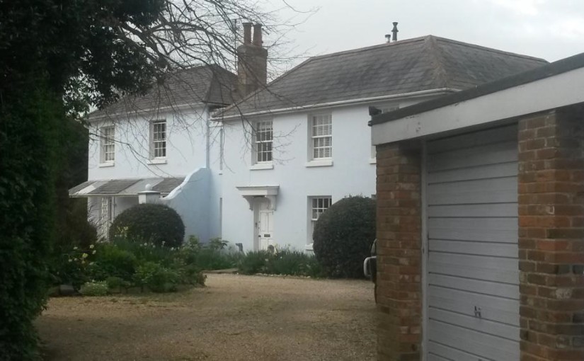
Always known as Westfield House, this is one of our older local buildings, built in the 1700s and extended in the early 1800s. When it was built, it was in the parish of New Fishbourne and not in Chichester at all!

When it was first listed as a building of special architectural significance, it was recorded as Westfield, Fishbourne Road. This was the main Chichester to Portsmouth road. Its postal address is now 80 Westgate and the property has been divided up into apartments.
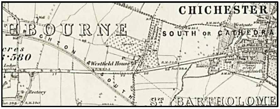
The first proper survey map (by George Loader 1813) shows the house clearly. There are also other points here we can recognise today – the squiggly line to the north of Westfield House is Hook Dyke (now partly in Neville Road), Apuldram Lane and Clay Lane are pretty much the same shape (and in “Fishbourn”) although the railway hasn’t yet been built.
The house is not depicted on this map from 1751

nor this one from 1787

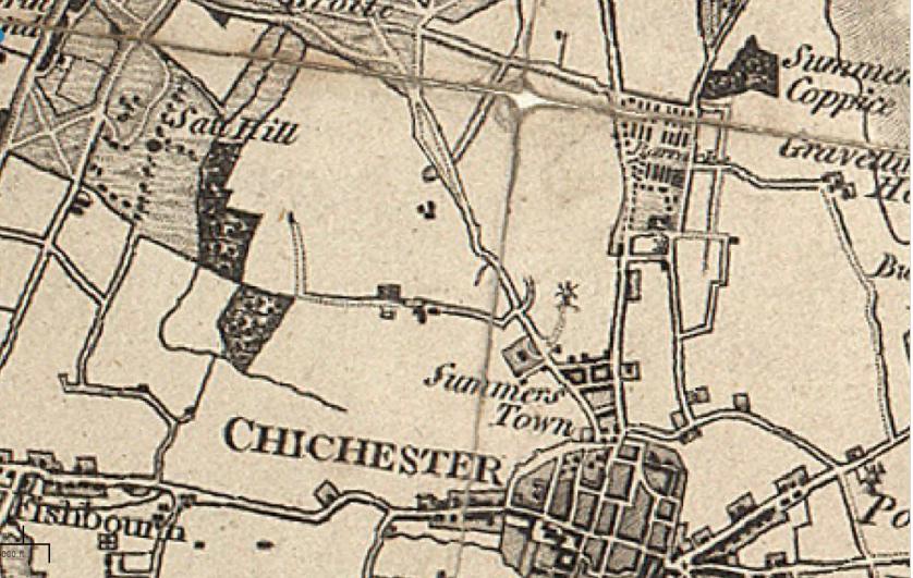
but it does show on the above Ordnance Survey map of 1875.
The nursery however is there already by 1751. Westfield House was next door to the “Nursery Farm”, and in the 19th century censuses there is some confusion whether these two were connected. Note too that Westgate has been straightened, as the semi-circular kink shown on maps from 1787 and 1813 is no longer there – although spookily that is where the north-western curve of today’s roundabout at the junction of Sherborne Road, would one day appear.
By 1900 Captain George Frank Price is living at Westfield House, and he was still there in 1950.
Westfield House in England was my Great Great Grandfather Benjamin Byron Williams’s House.
He lived in the Westfield House of Chicester, West Sussex in the 1890s.
Sincerely yours,
Dave Williams