The Westgate Residents’ Association

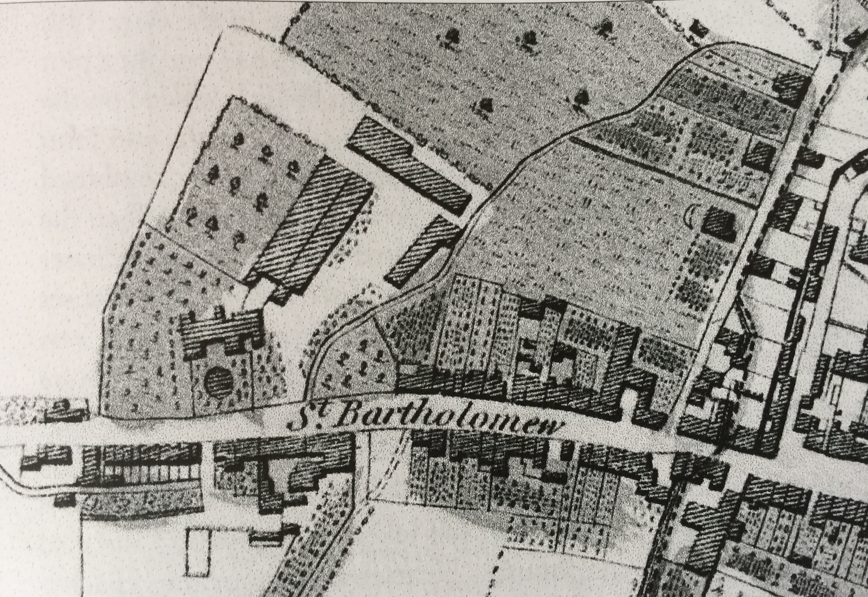
Westgate is now a desirable place to live but this has not always been the case.

When it first started to form as a suburb outside the West Gate on the road to Fishbourne, St Bartholomew’s was a poor industrial area. The Fishbourne road developed into the main road along the coast to the west, known as the Portsmouth Road; and in 1762 the road became the Chichester to Cosham turnpike, which meant that it was a toll road and better maintained. 

Successful day for Centurion Way 2018

A very successful exhibition was held on Saturday 27th January 2018 in the Scouts Hut by the newly formed Friends of Centurion Way.

The exhibition coincided with the launch of a written dossier detailing all the community issues that need to be considered in relation to any proposed diversion of the path’s southern end. The new Southern Access Road needs to cross the Centurion Way, but proposed land deals and draft plans have been shared that seek to divert the path by up to 750m – which will hugely impact current users, those with limited mobility etc.

Continue reading Successful day for Centurion Way 2018

The Future of Centurion Way 2018

The Committee are keen for interested residents to attend the “Friends of Centurion Way” Exhibition which is taking place this Saturday 27th January 2018 from 11.00 am – 3 pm at The Scout Hut on Sherborne Road, Chichester PO19 3AA. The Friends will be displaying material from their dossier of research about the path including information on:

Continue reading The Future of Centurion Way 2018

More on the Westgate Cycle Path 2016

Retired traffic consultant Paul Wreyford has been a key expert assisting the four RAs concerned with the impacts of the Whitehouse Farm development. He has over forty years of detailed highway and transport design and construction experience, and assessing developers highway designs has been a major part of this.

Following the approval of the outline plan for the development, Paul is now preparing to consider the more detailed design proposals that should be coming from the developers.

Continue reading More on the Westgate Cycle Path 2016

The Electoral Boundary Changes of May 2017

Please find below a screen shot of the recommended changes to our electoral boundary by the Local Government Boundary Commission for England (LGBCE), an independent body set up by Parliament, in respect of the county and district electoral divisions for our area.Here is a precis of their recommendations. You will find more detailed information at:
https://www.lgbce.org.uk/…/south-east/west-sussex/chichester.

Changes to democratic representation at Chichester District Council

Continue reading The Electoral Boundary Changes of May 2017

Suburb of St Bartholomew’s: C19th population

This text is the last in our series about the Suburb of St Bartholomew, through which Westgate runs. It consists of edited data selected from the 19th century censuses for the historic suburb of St Bartholomew (1801 to 1891) 

Continue reading Suburb of St Bartholomew’s: C19th population

Opening of The Brewery Field – June 2016 (updated)

Residents will probably know by now that the Field behind the County Record Office in Orchard Street has been taken over by Chichester City Council on a 25-year lease from the County Council for the use and enjoyment of all. It is very unusual these days to be able to organise the birth and activities of a new park in a City, particularly one in a conservation area and so close to the City Centre.

Continue reading Opening of The Brewery Field – June 2016 (updated)

error: Content is protected !!